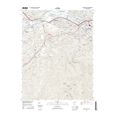
2014 Map of Charleston West
USGS Topo · Published 2014About this map
The Kanawha River serves as the central artery for this industrial and urban corridor, dividing the settlements of Dunbar and South Charleston from the metropolitan core of Charleston. The river's path is marked by a series of significant islands, including Tyler Island and Blaine Island, and is spanned by numerous crossings like the Patrick Street Bridge and the South Side Bridge. While the northern bank is dominated by the flatlands of the West Side, the southern topography rises sharply into the hollows and ridges of South Hills and Loudon Heights.
Find a feature on this map
93 named features on this map. Tap any name to fly to it.
Don’t see what you’re looking for? This feature index may not catch every label — zoom into the map to look around manually.
Map Details
Editions of this 2014 Charleston West Map
This is the sole edition of this map. No revisions or reprints were ever made.
Other maps of this area

1899 · Charleston
USGS Topo · 1:125,000

1909 · Charleston
USGS Topo · 1:62,500

1909 · Peytona
USGS Topo · 1:48,000

1909 · Saint Albans
USGS Topo · 1:62,500

1911 · Peytona
USGS Topo · 1:62,500

1911 · Madison
USGS Topo · 1:62,500

1929 · Madison
USGS Topo · 1:62,500

1929 · Peytona
USGS Topo · 1:62,500

1931 · Madison
USGS Topo · 1:62,500

1931 · Saint Albans
USGS Topo · 1:62,500