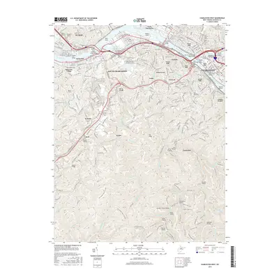
2016 Map of Charleston West
USGS Topo · Published 2016About this map
The Kanawha River serves as the central artery for this 2016 survey, dividing the urban centers of Charleston and South Charleston from Dunbar and West Side. The landscape is defined by a series of bridges, including the Patrick Street Bridge and the South Side Bridge, which facilitate the region's dense industrial and residential transit. South of the river, the terrain transitions into the steep ridges and hollows characteristic of the region, where names like Dryden Hollow and Porters Hollow mark the geography. Significant family and community history is preserved in numerous burial grounds, such as Sunset Memorial Cem and Graceland Cem. For those tracing outdoor and local history, the map details an extensive trail network including the Mary Draper Ingles Trail (KSF) and various paths through the hills like Alligator Rock Trail and Wildcat Ridge Trail, reflecting the modern balance between heavy industry along the CSX Transportation line and preserved woodland recreation.
Find a feature on this map
98 named features on this map. Tap any name to fly to it.
Don’t see what you’re looking for? This feature index may not catch every label — zoom into the map to look around manually.
Map Details
Editions of this 2016 Charleston West Map
This is the sole edition of this map. No revisions or reprints were ever made.
Other maps of this area

1899 · Charleston
USGS Topo · 1:125,000

1909 · Charleston
USGS Topo · 1:62,500

1909 · Peytona
USGS Topo · 1:48,000

1909 · Saint Albans
USGS Topo · 1:62,500

1911 · Peytona
USGS Topo · 1:62,500

1911 · Madison
USGS Topo · 1:62,500

1929 · Madison
USGS Topo · 1:62,500

1929 · Peytona
USGS Topo · 1:62,500

1931 · Madison
USGS Topo · 1:62,500

1931 · Saint Albans
USGS Topo · 1:62,500