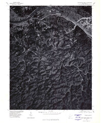
1977 Map of Charleston West
USGS Topo · Published 1980About this map
The Kanawha River carves a dominant path across the northern reaches of this 1977 orthophotoquad, serving as the central artery for the region's industrial and urban development. Produced in cooperation with the Soil Conservation Service, this aerial survey provides a sharp visual record of the winding ridge-and-valley topography that defines the land south of the water. The contrast between the dense residential and industrial corridors lining the riverbanks and the heavily wooded, steep-sloped terrain of the interior illustrates the geographical constraints on local expansion. This imagery captures the physical landscape during the late 1970s, documenting the footprint of development and the natural drainage patterns of the Appalachian hills before further modernization.
Find a feature on this map
1 named feature on this map. Tap any name to fly to it.
Don’t see what you’re looking for? This feature index may not catch every label — zoom into the map to look around manually.
Map Details
Editions of this 1977 Charleston West Map
This is the sole edition of this map. No revisions or reprints were ever made.
Other maps of this area

1899 · Charleston
USGS Topo · 1:125,000

1909 · Charleston
USGS Topo · 1:62,500

1909 · Peytona
USGS Topo · 1:48,000

1909 · Saint Albans
USGS Topo · 1:62,500

1911 · Peytona
USGS Topo · 1:62,500

1911 · Madison
USGS Topo · 1:62,500

1929 · Madison
USGS Topo · 1:62,500

1929 · Peytona
USGS Topo · 1:62,500

1931 · Madison
USGS Topo · 1:62,500

1931 · Saint Albans
USGS Topo · 1:62,500