
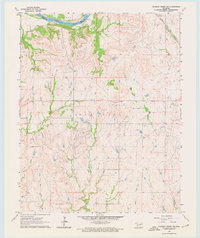
1964 Map of Charley Creek NE
USGS Topo · Published 1964About this map
The Arkansas River defines the northern reaches of this mid-1960s survey, marking the natural boundary between Longwood and the Big Hill area. This terrain is defined by a dense network of drainages, including the West Fork, Middle Fork, and East Fork of Charley Creek, which flow southward into a series of smaller tributaries like Jim Creek and Clear Creek. The extractive industry of the region is clearly visible, with numerous Oil Wells scattered across the landscape, particularly concentrated in the northern and western sections.
Find a feature on this map
16 named features on this map. Tap any name to fly to it.
Don’t see what you’re looking for? This feature index may not catch every label — zoom into the map to look around manually.
Map Details
Editions of this 1964 Charley Creek NE Map
2 editions found
Other maps of this area

1916 · Foraker
USGS Topo · 1:62,500

1932 · Fairfax
USGS Topo · 1:62,500

1935 · Kaw
USGS Topo · 1:62,500

1936 · Belford
USGS Topo · 1:62,500

1955 · Enid
USGS Topo · 1:250,000

1958 · Enid
USGS Topo · 1:250,000

1963 · Charley Creek
USGS Topo · 1:24,000

1963 · Uncas
USGS Topo · 1:24,000

1964 · Kaw City
USGS Topo · 1:24,000
1964 · Shidler
USGS Topo · 1:24,000