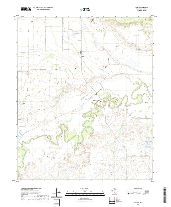
2022 Map of Charlie
USGS Topo · Published 2022About this map
The Charlie settlement in Clay County sits atop the plains north of the winding Wichita River, which defines the local topography with its extensive oxbows and river bends. The landscape is marked by the distinct elevation of Pumpkin Ridge to the northeast and the seasonal hydrology of Byers Lake and Hay Cr. This modern 2022 survey documents the rural road network including Fleming School Rd, which hints at the locations of former community centers. Genealogists and local historians can pinpoint the Charlie Cem situated west of the main town site. Further southeast, the presence of Petrolia Lake Number 1 and Petrolia Lake Number 2 highlights the water management and agricultural needs of this North Texas region.
Find a feature on this map
36 named features on this map. Tap any name to fly to it.
Don’t see what you’re looking for? This feature index may not catch every label — zoom into the map to look around manually.
Map Details
Editions of this 2022 Charlie Map
This is the sole edition of this map. No revisions or reprints were ever made.
Other maps of this area

1954 · Wichita Falls
USGS Topo · 1:250,000

1955 · Lawton
USGS Topo · 1:250,000

1956 · Henrietta
USGS Topo · 1:62,500

1957 · Hastings
USGS Topo · 1:62,500

1957 · Randlett
USGS Topo · 1:62,500

1957 · Wichita Falls East
USGS Topo · 1:62,500

1957 · Wichita Falls East
USGS Topo · 1:24,000

1958 · Wichita Falls
USGS Topo · 1:250,000
1972 · Dean
USGS Topo · 1:24,000
1972 · Thornberry
USGS Topo · 1:24,000