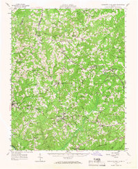
1956 Map of Charlotte Court House
USGS Topo · Published 1967About this map
The county seat of Charlotte Court House serves as the central hub of this mid-century Virginia landscape, where the agricultural traditions of the Piedmont are mapped in detail. The terrain is defined by the winding paths of Wards Fork and Little Roanoke Creek, while higher ground is marked by prominent elevations like Baker Mtn and Mt Tirzah. This area reflects a deep-rooted social fabric centered on crossroads settlements and country congregations such as Alabama Ch and Spring Creek Ch.
Find a feature on this map
93 named features on this map. Tap any name to fly to it.
Don’t see what you’re looking for? This feature index may not catch every label — zoom into the map to look around manually.
Map Details
Editions of this 1956 Charlotte Court House Map
2 editions found

Other maps of this area

1891 · Farmville
USGS Topo · 1:125,000

1892 · Appomattox
USGS Topo · 1:125,000

1893 · Farmville
USGS Topo · 1:125,000

1947 · Roanoke
USGS Topo · 1:250,000

1953 · Greensboro
USGS Topo · 1:250,000

1954 · Greensboro
USGS Topo · 1:250,000

1954 · Clover
USGS Topo · 1:62,500

1954 · Halifax
USGS Topo · 1:62,500

1955 · Chase City
USGS Topo · 1:62,500

1956 · Brookneal
USGS Topo · 1:62,500