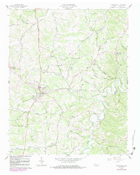
1958 Map of Charlotte
USGS Topo · Published 1983About this map
Charlotte serves as the focal point of this Dickson County landscape, established well before this mid-century topographic survey. The settlement pattern reflects a classic rural Tennessee layout, where community life centered around small congregations like Oak Grove Ch, Mt Hebron Ch, and Rock Ch. The local infrastructure includes the High Sch and Cedar Grove Sch, while the County Farm near Jones Creek indicates the social services of the era.
Find a feature on this map
80 named features on this map. Tap any name to fly to it.
Don’t see what you’re looking for? This feature index may not catch every label — zoom into the map to look around manually.
Map Details
Editions of this 1958 Charlotte Map
2 editions found
Other maps of this area

1930 · White Bluff
USGS Topo · 1:62,500

1933 · White Bluff
USGS Topo · 1:62,500

1936 · Burns
USGS Topo · 1:24,000

1936 · Dickson
USGS Topo · 1:24,000

1953 · Dickson
USGS Topo · 1:24,000

1953 · Burns
USGS Topo · 1:24,000

1956 · Nashville
USGS Topo · 1:250,000

1957 · Cheatham Dam
USGS Topo · 1:24,000

1958 · Charlotte
USGS Topo · 1:24,000

1958 · Cumberland Furnace
USGS Topo · 1:24,000