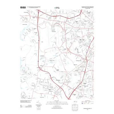
2013 Map of Charlotte West
USGS Topo · Published 2013About this map
Charlotte/Douglas International Airport serves as a massive central anchor for this western Mecklenburg County landscape, where urban expansion meets older rural roots. Historically significant sites like the Hunters Dairy Farm and Mount Olive Church stand alongside newer suburban developments such as Olde Whitehall and Olympic Woods. The map illustrates the region's transition from a collection of dispersed settlements like Shopton and Berryhill to a dense residential and commercial hub, particularly near the Charlotte Coliseum. Drainage for the area is dominated by the south-flowing Sugar Cr, Irwin Cr, and Coffey Cr, which eventually lead toward the banks of Lake Wylie on the western edge. This map documents a critical period of growth where remnants of local history, such as the Steele Creek Post Number 221-American Legion, remain visible amidst a changing grid of interstates and air terminals.
Find a feature on this map
414 named features on this map. Tap any name to fly to it.
Don’t see what you’re looking for? This feature index may not catch every label — zoom into the map to look around manually.
Map Details
Editions of this 2013 Charlotte West Map
This is the sole edition of this map. No revisions or reprints were ever made.
Other maps of this area

1905 · Charlotte
USGS Topo · 1:48,000

1907 · Charlotte
USGS Topo · 1:62,500

1914 · Gastonia
USGS Topo · 1:48,000

1916 · Gastonia
USGS Topo · 1:62,500

1941 · Charlotte
USGS Topo · 1:125,000

1942 · Charlotte
USGS Topo · 1:125,000

1947 · Clover
USGS Topo · 1:62,500

1948 · Paw Creek
USGS Topo · 1:24,000

1948 · Derita
USGS Topo · 1:24,000

1948 · Charlotte East
USGS Topo · 1:24,000