
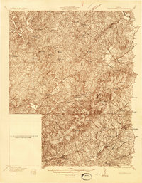
1935 Map of Charlottesville
USGS Topo · Published 1935About this map
Charlottesville and the surrounding Albemarle County landscape are captured here in the mid-1930s, centered on the confluence of the North Fork Rivanna River and South Fork Rivanna River. The area's legacy is visible through its historic estates and institutions, from the hilltop grounds of Monticello and the nearby Blue Ridge Sanatorium to the University Cemetery on the city's western edge. The Southwest Mountains form a prominent spine to the east, dotted with family-named landmarks like Castle Hill and Peters Mtn.
Find a feature on this map
103 named features on this map. Tap any name to fly to it.
Don’t see what you’re looking for? This feature index may not catch every label — zoom into the map to look around manually.
Map Details
Editions of this 1935 Charlottesville Map
2 editions found
Other maps of this area

1891 · Palmyra
USGS Topo · 1:125,000

1892 · Buckingham
USGS Topo · 1:125,000

1892 · Gordonsville
USGS Topo · 1:125,000

1892 · Harrisonburg
USGS Topo · 1:125,000

1895 · Palmyra
USGS Topo · 1:125,000

1897 · Palmyra
USGS Topo · 1:125,000

1929 · Covesville
USGS Topo · 1:62,500

1930 · Madison
USGS Topo · 1:48,000

1931 · University
USGS Topo · 1:62,500

1933 · Madison
USGS Topo · 1:62,500