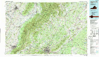
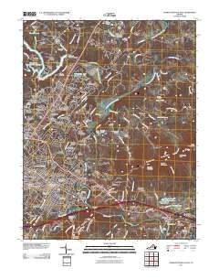
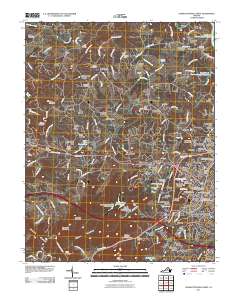
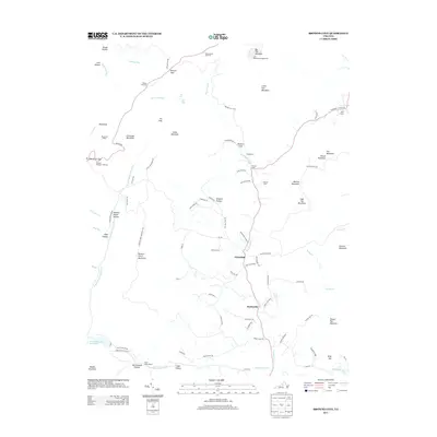
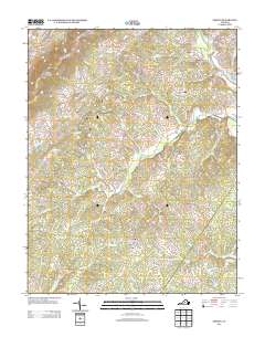
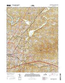
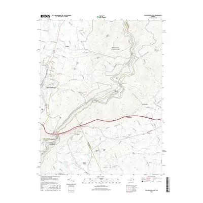
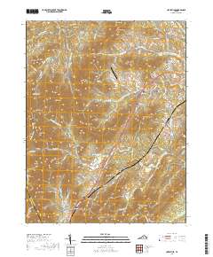
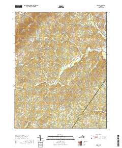
1986 Map of Charlottesville
USGS Topo · Published 1989About this map
The Blue Ridge Mountains dominate this mid-1980s landscape, serving as the central spine between the Shenandoah Valley and the Virginia Piedmont. Within Shenandoah National Park, iconic peaks like Stony Man and Hawksbill rise above the winding path of Skyline Drive, while the lower slopes reveal the complex hydrology of the South Fork Shenandoah River and the Rivanna River systems. The map documents a period of established infrastructure, with Interstate 64 and several US Highways linking the regional hubs of Charlottesville, Harrisonburg, and Waynesboro.
Find a feature on this map
178 named features on this map. Tap any name to fly to it.
Don’t see what you’re looking for? This feature index may not catch every label — zoom into the map to look around manually.
Map Details
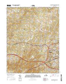
Editions of this 1986 Charlottesville Map
3 editions found

Historical Maps of Harrisonburg Through Time
71 maps found

1929 Covesville
Albemarle County, VA

1931 University
Albemarle County, VA

1935 Charlottesville
Albemarle County, VA

1935 Covesville
Albemarle County, VA

1935 University
Albemarle County, VA

1939 Charlottesville
Albemarle County, VA

1945 Covesville
Albemarle County, VA

1949 Charlottesville
Albemarle County, VA

1949 Charlottesville
Albemarle County, VA

1956 Charlottesville
Albemarle County, VA

1964 Charlottesville East
Albemarle County, VA

1964 Charlottesville West
Albemarle County, VA

1964 Waynesboro East
Albemarle County, VA

1965 Browns Cove
Albemarle County, VA

1967 Alberene
Albemarle County, VA

1967 Covesville
Albemarle County, VA

1967 Simeon
Albemarle County, VA

1972 Charlottesville East
Albemarle County, VA

1972 Charlottesville West
Albemarle County, VA

1972 Waynesboro East
Albemarle County, VA

1973 Charlottesville East
Albemarle County, VA

1973 Charlottesville West
Albemarle County, VA

1973 Waynesboro East
Albemarle County, VA

1977 Browns Cove
Albemarle County, VA

1977 Charlottesville East
Albemarle County, VA

1977 Charlottesville West
Albemarle County, VA

1977 Waynesboro East
Albemarle County, VA

1979 Alberene
Albemarle County, VA

1979 Covesville
Albemarle County, VA

1979 Simeon
Albemarle County, VA

1986 Charlottesville
Albemarle County, VA

1997 Browns Cove
Albemarle County, VA

1997 Charlottesville East
Albemarle County, VA

1997 Charlottesville West
Albemarle County, VA

1997 Waynesboro East
Albemarle County, VA

1999 Covesville
Albemarle County, VA
2010 Alberene
Albemarle County, VA
2010 Browns Cove
Albemarle County, VA
2010 Covesville
Albemarle County, VA
2011 Charlottesville East
Albemarle County, VA
2011 Charlottesville West
Albemarle County, VA

2011 Simeon
Albemarle County, VA
2011 Waynesboro East
Albemarle County, VA
2013 Alberene
Albemarle County, VA
2013 Browns Cove
Albemarle County, VA
2013 Charlottesville East
Albemarle County, VA
2013 Charlottesville West
Albemarle County, VA
2013 Covesville
Albemarle County, VA
2013 Simeon
Albemarle County, VA
2013 Waynesboro East
Albemarle County, VA
2016 Alberene
Albemarle County, VA
2016 Browns Cove
Albemarle County, VA
2016 Charlottesville East
Albemarle County, VA
2016 Charlottesville West
Albemarle County, VA
2016 Covesville
Albemarle County, VA
2016 Simeon
Albemarle County, VA
2016 Waynesboro East
Albemarle County, VA
2019 Alberene
Albemarle County, VA

2019 Browns Cove
Albemarle County, VA
2019 Charlottesville East
Albemarle County, VA
2019 Charlottesville West
Albemarle County, VA
2019 Covesville
Albemarle County, VA
2019 Simeon
Albemarle County, VA
2019 Waynesboro East
Albemarle County, VA

2022 Alberene
Albemarle County, VA

2022 Browns Cove
Albemarle County, VA

2022 Charlottesville East
Albemarle County, VA
2022 Charlottesville West
Albemarle County, VA

2022 Covesville
Albemarle County, VA

2022 Simeon
Albemarle County, VA

2022 Waynesboro East
Albemarle County, VA