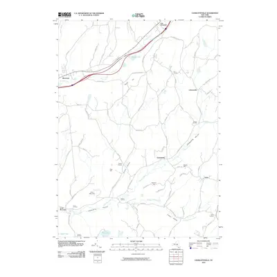
2010 Map of Charlotteville
USGS Topo · Published 2010About this map
Charlotte Creek carves through the prominent Charlotte Valley in this region of Otsego County, where high ridges like Strain Mountain and South Hill define the rural landscape. The northern portion of the map is anchored by the twin settlements of Worcester and East Worcester, situated along the winding course of Schenevus Creek. This area illustrates a typical New York upland settlement pattern, with small hamlets and namesake crossroads like Lutheranville, Barton Corners, and Baird Corners scattered along the valley floors and higher elevations.
Find a feature on this map
71 named features on this map. Tap any name to fly to it.
Don’t see what you’re looking for? This feature index may not catch every label — zoom into the map to look around manually.
Map Details
Editions of this 2010 Charlotteville Map
This is the sole edition of this map. No revisions or reprints were ever made.
Other maps of this area

1904 · Richmondville
USGS Topo · 1:62,500

1904 · Hobart
USGS Topo · 1:62,500

1907 · Cooperstown
USGS Topo · 1:62,500

1909 · Cooperstown
USGS Topo · 1:62,500

1909 · Delhi
USGS Topo · 1:62,500

1911 · Delhi
USGS Topo · 1:62,500

1943 · South Valley
USGS Topo · 1:24,000

1943 · Westford
USGS Topo · 1:24,000

1943 · Charlotteville
USGS Topo · 1:24,000
1943 · Schenevus
USGS Topo · 1:24,000