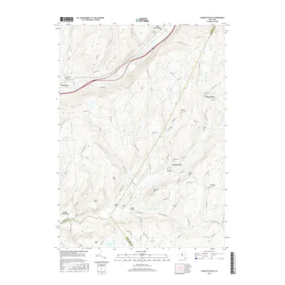
2016 Map of Charlotteville
USGS Topo · Published 2016About this map
Schenevus Cr carves a path through the northern highlands of this Otsego County landscape, providing a low-elevation corridor for rail and road transit between Worcester and East Worcester. This 2016 survey illustrates the persistent rural character of the upper Susquehanna watershed, where small settlements like Lutheranville and Charlotteville remain anchored by their namesake watercourses. The map is particularly valuable for genealogists, as it meticulously identifies numerous family and community burial grounds, including Snooks Cem, Fox Cem, and the Saint Joseph's Roman Catholic Cem.
Find a feature on this map
90 named features on this map. Tap any name to fly to it.
Don’t see what you’re looking for? This feature index may not catch every label — zoom into the map to look around manually.
Map Details
Editions of this 2016 Charlotteville Map
This is the sole edition of this map. No revisions or reprints were ever made.
Other maps of this area

1904 · Richmondville
USGS Topo · 1:62,500

1904 · Hobart
USGS Topo · 1:62,500

1907 · Cooperstown
USGS Topo · 1:62,500

1909 · Cooperstown
USGS Topo · 1:62,500

1909 · Delhi
USGS Topo · 1:62,500

1911 · Delhi
USGS Topo · 1:62,500

1943 · South Valley
USGS Topo · 1:24,000

1943 · Westford
USGS Topo · 1:24,000

1943 · Charlotteville
USGS Topo · 1:24,000
1943 · Schenevus
USGS Topo · 1:24,000