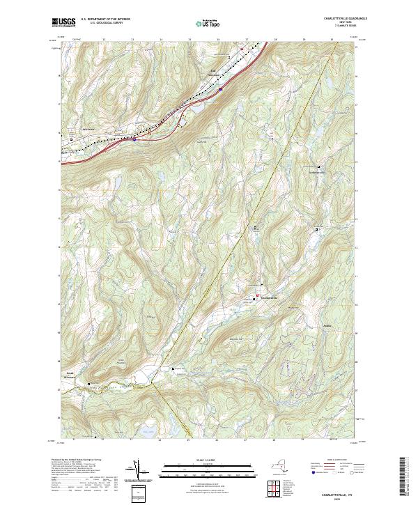
2023 Map of Charlotteville
USGS Topo · Published 2023About this map
The northern corridor of the Otsego County highlands is defined by the parallel paths of Schenevus Creek and the railroad, passing through the established settlements of Worcester and East Worcester. This area shows a persistent pattern of rural valley life, where local family names and small-town institutions anchor the landscape. To the south, the terrain becomes more varied as it descends into the Charlotte Valley, where the waters of Charlotte Creek gather from several tributaries like Clapper Hollow Creek.
Find a feature on this map
101 named features on this map. Tap any name to fly to it.
Don’t see what you’re looking for? This feature index may not catch every label — zoom into the map to look around manually.
Map Details
Editions of this 2023 Charlotteville Map
This is the sole edition of this map. No revisions or reprints were ever made.
Other maps of this area

1904 · Richmondville
USGS Topo · 1:62,500

1904 · Hobart
USGS Topo · 1:62,500

1907 · Cooperstown
USGS Topo · 1:62,500

1909 · Cooperstown
USGS Topo · 1:62,500

1909 · Delhi
USGS Topo · 1:62,500

1911 · Delhi
USGS Topo · 1:62,500

1943 · South Valley
USGS Topo · 1:24,000

1943 · Westford
USGS Topo · 1:24,000

1943 · Charlotteville
USGS Topo · 1:24,000
1943 · Schenevus
USGS Topo · 1:24,000