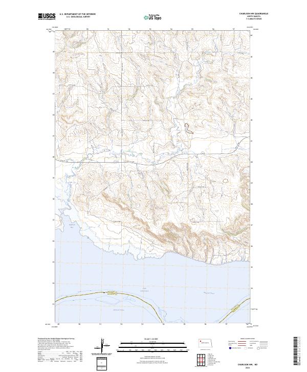
2024 Map of Charlson NW
USGS Topo · Published 2024About this map
Lake Sakakawea and the broad Missouri River define the southern landscape of this Williams County quadrangle. The map documents the intricate shoreline where Dry Fork Creek feeds into Hofflund Bay, a primary drainage feature for the upland plateau to the north. This region is characterized by a strict section-line road grid, including 105th Ave NW and 57th St NW, which segment the agricultural land and coulees typical of the northern Missouri River valley. Significant local transit routes such as Co Hwy 23 and Route 1804 facilitate movement across the dissected terrain, connecting the high plains to the water's edge at the Williams and McKenzie County line.
Find a feature on this map
21 named features on this map. Tap any name to fly to it.
Don’t see what you’re looking for? This feature index may not catch every label — zoom into the map to look around manually.
Map Details
Editions of this 2024 Charlson NW Map
This is the sole edition of this map. No revisions or reprints were ever made.
Other maps of this area

1911 · Ray
USGS Topo · 1:125,000

1953 · Williston
USGS Topo · 1:250,000

1957 · Williston
USGS Topo · 1:250,000

1965 · Charlson
USGS Topo · 1:24,000

1965 · Charlson SW
USGS Topo · 1:24,000

1965 · Charlson NE
USGS Topo · 1:24,000

1965 · Charlson NW
USGS Topo · 1:24,000

1969 · Red Mike Hill
USGS Topo · 1:24,000

1978 · Tobacco Garden Bay
USGS Topo · 1:24,000

1978 · Ray SE
USGS Topo · 1:24,000