
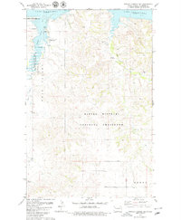
1978 Map of Tobacco Garden Bay
USGS Topo · Published 1979About this map
Lake Sakakawea dominates the northern reaches of this McKenzie County landscape, where the waters of Tobacco Garden Bay meet the undulating terrain of northwestern North Dakota. The shoreline reflects the engineering of the mid-20th century, with underwater contours sourced from 1943 data. To the south, the Little Missouri National Grassland covers a significant portion of the quadrangle, preserved alongside the Tobacco Garden Creek State Game Management Area.
Find a feature on this map
17 named features on this map. Tap any name to fly to it.
Don’t see what you’re looking for? This feature index may not catch every label — zoom into the map to look around manually.
Map Details
Editions of this 1978 Tobacco Garden Bay Map
2 editions found
Other maps of this area

1911 · Ray
USGS Topo · 1:125,000

1953 · Williston
USGS Topo · 1:250,000

1953 · Watford City
USGS Topo · 1:250,000

1957 · Williston
USGS Topo · 1:250,000

1957 · Watford City
USGS Topo · 1:250,000

1965 · Keene
USGS Topo · 1:24,000

1965 · Charlson SW
USGS Topo · 1:24,000

1965 · Charlson NW
USGS Topo · 1:24,000

1967 · Watford City
USGS Topo · 1:250,000

1969 · Cussicks Spring
USGS Topo · 1:24,000