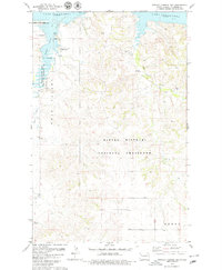
1978 Map of Tobacco Garden Bay
USGS Topo · Published 1979About this map
Lake Sakakawea dominates the northern reaches of this Missouri River plateau landscape, where the waters of Tobacco Garden Bay reach deep into the surrounding breaks. This 1970s survey captures a transition between the managed shorelines of the Tobacco Garden Creek State Game Management Area and the high, open reaches of the Little Missouri National Grassland. The terrain is characterized by the broad floor of Twin Valley and the intricate drainage systems of Tobacco Garden Creek and Sand Creek. Near the southern boundary, the settlement of Keene sits atop the higher plains, while the lakefront supports recreation at the Tobacco Garden Creek Recreation Area and various campgrounds. Subtle industrial markers like a Drill Hole and Gravel Pit appear alongside sections of the Public Domain, illustrating the mixed use of this North Dakota landscape decades after the reservoir's creation.
Find a feature on this map
16 named features on this map. Tap any name to fly to it.
Don’t see what you’re looking for? This feature index may not catch every label — zoom into the map to look around manually.
Map Details
Editions of this 1978 Tobacco Garden Bay Map
2 editions found

Other maps of this area

1911 · Ray
USGS Topo · 1:125,000

1953 · Williston
USGS Topo · 1:250,000

1953 · Watford City
USGS Topo · 1:250,000

1957 · Williston
USGS Topo · 1:250,000

1957 · Watford City
USGS Topo · 1:250,000

1965 · Keene
USGS Topo · 1:24,000

1965 · Charlson SW
USGS Topo · 1:24,000

1965 · Charlson NW
USGS Topo · 1:24,000

1967 · Watford City
USGS Topo · 1:250,000

1969 · Cussicks Spring
USGS Topo · 1:24,000