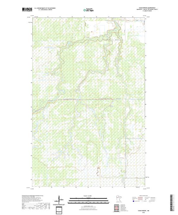
2022 Map of Chase Brook
USGS Topo · Published 2022About this map
Rapid River and its network of tributaries define this wetland-rich landscape in northern Minnesota. This modern survey illustrates a heavily managed and protected wilderness where the Consolidated Conservation Trails Trl winds through dense marshland and forests. The drainage pattern is intricate, with Chase Brook, Miller Cr, and Thompson Cr all feeding into the larger river system. Human presence is largely limited to the periphery, marked by corridors like Rapid River Rd and Co Hwy 1. The map provides a clear look at the Public Land Survey System grid across Townships 157 and 158 North, showing how section lines and access roads like 91st St SW and 17th Ave SW navigate the low-lying terrain. It is a vital record for understanding the modern conservation footprint in Lake of the Woods County.
Find a feature on this map
19 named features on this map. Tap any name to fly to it.
Don’t see what you’re looking for? This feature index may not catch every label — zoom into the map to look around manually.
Map Details
Editions of this 2022 Chase Brook Map
This is the sole edition of this map. No revisions or reprints were ever made.
Other maps of this area

1919 · Peppermint Creek
USGS Topo · 1:62,500

1919 · G
USGS Topo · 1:62,500

1919 · Knutson
USGS Topo · 1:62,500

1921 · Baudette
USGS Topo · 1:62,500

1943 · Peppermint Creek
USGS Topo · 1:62,500

1954 · Roseau
USGS Topo · 1:250,000

1957 · Roseau
USGS Topo · 1:250,000

1958 · Roseau
USGS Topo · 1:250,000

1968 · Baudette SE
USGS Topo · 1:24,000
1968 · Graceton SE
USGS Topo · 1:24,000