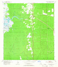
1954 Map of Chassahowitzka
USGS Topo · Published 1968About this map
Chassahowitzka serves as the primary upland anchor in this mid-century topographic study of the Gulf Coast, where the Florida spring-fed river system meets the expansive Chassahowitzka Swamp. The landscape is dominated by a complex network of tidally influenced waterways including Potter Creek, Baird Cr, and Johnson Creek as they feed into the main Chassahowitzka River. This environment is preserved within the Chassahowitzka National Wildlife Refuge, which encompasses various coastal landforms like Garden Island and Anclote Hammock.
Find a feature on this map
23 named features on this map. Tap any name to fly to it.
Don’t see what you’re looking for? This feature index may not catch every label — zoom into the map to look around manually.
Map Details
Editions of this 1954 Chassahowitzka Map
4 editions found
Other maps of this area

1895 · Tsala Apopka
USGS Topo · 1:62,500

1954 · Lecanto
USGS Topo · 1:24,000

1954 · Homosassa
USGS Topo · 1:24,000

1954 · Chassahowitzka Bay
USGS Topo · 1:24,000

1954 · Brooksville NW
USGS Topo · 1:24,000

1954 · Brooksville
USGS Topo · 1:24,000

1954 · Chassahowitzka
USGS Topo · 1:24,000

1954 · Bayport
USGS Topo · 1:24,000

1954 · Weekiwachee Springs
USGS Topo · 1:24,000

1954 · Ozello
USGS Topo · 1:24,000