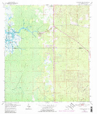
1954 Map of Chassahowitzka
USGS Topo · Published 1989About this map
Chassahowitzka sits at the edge of a massive coastal wetland system where the Chassahowitzka River meets the Gulf of Mexico. This map, based on mid-century surveys with updates through the 1980s, documents the intricate drainage of the Chassahowitzka Swamp, characterized by a complex network of tidally influenced streams such as Potter Creek, Baird Creek, and Crawford Creek. A notable detail of the changing landscape is the Bridge (Abandoned) located north of the settlement, suggesting an older route once used before modern infrastructure corridors like Highway 19 and Highway 98 were established.
Find a feature on this map
24 named features on this map. Tap any name to fly to it.
Don’t see what you’re looking for? This feature index may not catch every label — zoom into the map to look around manually.
Map Details
Editions of this 1954 Chassahowitzka Map
4 editions found
Other maps of this area

1895 · Tsala Apopka
USGS Topo · 1:62,500

1954 · Lecanto
USGS Topo · 1:24,000

1954 · Homosassa
USGS Topo · 1:24,000

1954 · Chassahowitzka Bay
USGS Topo · 1:24,000

1954 · Brooksville NW
USGS Topo · 1:24,000

1954 · Brooksville
USGS Topo · 1:24,000

1954 · Chassahowitzka
USGS Topo · 1:24,000

1954 · Bayport
USGS Topo · 1:24,000

1954 · Weekiwachee Springs
USGS Topo · 1:24,000

1954 · Ozello
USGS Topo · 1:24,000