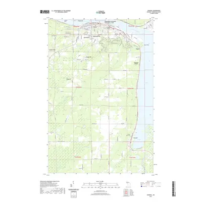
2019 Map of Chassell
USGS Topo · Published 2019About this map
Houghton and Hancock anchor this portion of Michigan’s Copper Country, connected across the Keweenaw Waterway in a landscape shaped by early mining and industrial development. The city of Houghton serves as the focal point, home to the Michigan Technological University campus and the prominent Houghton County Courthouse. To the south, settlements like Atlantic Mine, Dodgeville, and Hurontown reflect the region's historic mining operations.
Find a feature on this map
49 named features on this map. Tap any name to fly to it.
Don’t see what you’re looking for? This feature index may not catch every label — zoom into the map to look around manually.
Map Details
Editions of this 2019 Chassell Map
This is the sole edition of this map. No revisions or reprints were ever made.
Other maps of this area

1915 · Houghton
USGS Topo · 1:62,500

1946 · Hancock
USGS Topo · 1:24,000

1946 · Chassell
USGS Topo · 1:24,000

1946 · South Range
USGS Topo · 1:24,000

1946 · Laurium
USGS Topo · 1:24,000

1948 · South Range
USGS Topo · 1:24,000

1948 · Laurium
USGS Topo · 1:24,000

1948 · Hancock
USGS Topo · 1:24,000

1948 · Chassell
USGS Topo · 1:24,000

1954 · Oskar
USGS Topo · 1:24,000