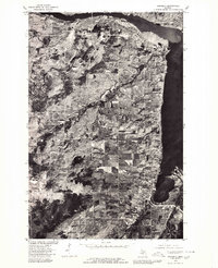
1978 Map of Chassell
USGS Topo · Published 1980About this map
Houghton and Hancock dominate the northern landscape of this orthophotoquad, which uses aerial photography from 1978 to reveal the settlement patterns of Michigan’s Copper Country. The imagery provides a clear view of the industrial and residential footprints in Hurontown and Dodgeville, while the namesake community of Chassell sits at the southern edge where the Sturgeon River meets the widening waters.
Find a feature on this map
9 named features on this map. Tap any name to fly to it.
Don’t see what you’re looking for? This feature index may not catch every label — zoom into the map to look around manually.
Map Details
Editions of this 1978 Chassell Map
This is the sole edition of this map. No revisions or reprints were ever made.
Other maps of this area

1915 · Houghton
USGS Topo · 1:62,500

1946 · Hancock
USGS Topo · 1:24,000

1946 · Chassell
USGS Topo · 1:24,000

1946 · South Range
USGS Topo · 1:24,000

1946 · Laurium
USGS Topo · 1:24,000

1948 · South Range
USGS Topo · 1:24,000

1948 · Laurium
USGS Topo · 1:24,000

1948 · Hancock
USGS Topo · 1:24,000

1948 · Chassell
USGS Topo · 1:24,000

1954 · Oskar
USGS Topo · 1:24,000