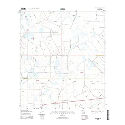
2015 Map of Chataignier
USGS Topo · Published 2015About this map
Chataignier sits at the heart of this agricultural landscape in the Cajun prairie region of Louisiana. The area is defined by the distinct boundary between Evangeline Parish and ST. Landry Parish, where the flat plains of Prairie Mamou and Prairie Rhonde are etched by meandering waterways like Bayou Marron, Bayou Doza, and Bayou des Cannes. These bayous, along with smaller drainages such as Pine Point Gully and Beacons Gully, dictated the early settlement patterns and road networks that still crisscross the fields today.
Find a feature on this map
116 named features on this map. Tap any name to fly to it.
Don’t see what you’re looking for? This feature index may not catch every label — zoom into the map to look around manually.
Map Details
Editions of this 2015 Chataignier Map
This is the sole edition of this map. No revisions or reprints were ever made.
Other maps of this area

1939 · Opelousas
USGS Topo · 1:62,500

1947 · Ville Platte
USGS Topo · 1:31,680

1947 · Redland
USGS Topo · 1:31,680

1947 · Chataignier
USGS Topo · 1:31,680

1947 · Eunice
USGS Topo · 1:31,680

1947 · Pitreville
USGS Topo · 1:31,680

1952 · Lake Charles
USGS Topo · 1:250,000

1954 · Lake Charles
USGS Topo · 1:250,000

1956 · Opelousas
USGS Topo · 1:62,500

1957 · Opelousas
USGS Topo · 1:62,500