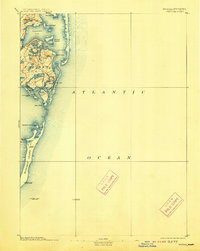
1893 Map of Chatham
USGS Topo · Published 1913About this map
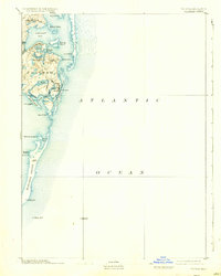
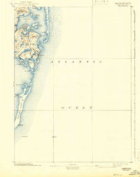
The maritime landscape of Chatham is defined by its precarious relationship with the Atlantic Ocean, as documented in this late 19th-century survey. The coastline is dominated by shifting barrier features like the elongated Monomoy Island and the protective reach of Nauset Beach, which shields Chatham Harbor. Human settlement is concentrated in Chatham Port, North Chatham, and the primary village near Oyster Pond. To ensure safe passage through these treacherous shoals and narrow inlets, a network of navigational aids is clearly marked, including the Chatham Lights and the Harding Beach Light. Further offshore, the Pollock Rip Light Ship and Shovelful Shoal Light Ship signal the submerged hazards that dictated the local economy and maritime history of this Cape Cod region before modern coastal engineering.
Find a feature on this map
36 named features on this map. Tap any name to fly to it.
Don’t see what you’re looking for? This feature index may not catch every label — zoom into the map to look around manually.
Map Details
Editions of this 1893 Chatham Map
7 editions found
Other maps of this area

1887 · Wellfleet
USGS Topo · 1:62,500

1887 · Yarmouth
USGS Topo · 1:62,500

1888 · Chatham
USGS Topo · 1:62,500

1889 · Yarmouth
USGS Topo · 1:62,500

1889 · Wellfleet
USGS Topo · 1:62,500

1893 · Chatham
USGS Topo · 1:62,500

1893 · Yarmouth
USGS Topo · 1:62,500

1893 · Wellfleet
USGS Topo · 1:62,500

1917 · Chatham
USGS Topo · 1:62,500

1942 · Cape Cod Bay
USGS Topo · 1:125,000