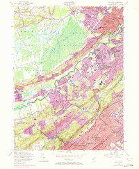
1955 Map of Chatham
USGS Topo · Published 1972About this map
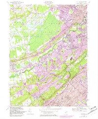
Chatham and the surrounding suburban corridors of Northern New Jersey are caught in a period of significant postwar expansion in this mid-century survey. While established centers like Summit and Madison show dense residential patterns, the purple-tinted revisions indicate rapid urban extension into previously wooded areas. The landscape is defined by the prominent Watchung Mountains and the winding Passaic River, which separates Morris and Somerset counties.
Find a feature on this map
108 named features on this map. Tap any name to fly to it.
Don’t see what you’re looking for? This feature index may not catch every label — zoom into the map to look around manually.
Map Details
Editions of this 1955 Chatham Map
7 editions found
Other maps of this area

1888 · Plainfield
USGS Topo · 1:62,500

1888 · Morristown
USGS Topo · 1:62,500

1888 · Lake Hopatcong
USGS Topo · 1:62,500

1891 · Somerville
USGS Topo · 1:62,500

1893 · Plainfield
USGS Topo · 1:62,500

1893 · Somerville
USGS Topo · 1:62,500

1894 · Morristown
USGS Topo · 1:62,500

1894 · Lake Hopatcong
USGS Topo · 1:62,500

1898 · Lake Hopatcong
USGS Topo · 1:62,500

1898 · Morristown
USGS Topo · 1:62,500