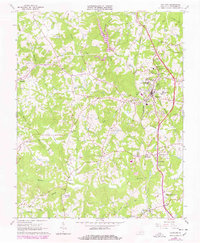
1965 Map of Chatham
USGS Topo · Published 1978About this map
The Southern railroad corridor anchors the community of Chatham in this mid-1960s survey, updated with late 1970s photogrammetric data. Educational and institutional life is central to the landscape, featuring the Hargrave Military Academy and Chatham Hall Sch campus grounds, alongside the Virginia Polytechnic Institute Tobacco Research Station to the southeast. The Banister River and its tributaries, including Pudding Creek and Bearskin Creek, carve through the rolling terrain, while smaller settlements like Tight Squeeze, Hollywood, and Weal are connected by a network of rural routes. The presence of State Prison Camp No 15 and numerous local congregations such as Concord Ch and Rehobeth Ch reflect the area's social fabric. Downstream on the Banister River, the map identifies Jones Mill, signaling the persistent legacy of river-based industry in Pittsylvania County.
Find a feature on this map
52 named features on this map. Tap any name to fly to it.
Don’t see what you’re looking for? This feature index may not catch every label — zoom into the map to look around manually.
Map Details
Editions of this 1965 Chatham Map
3 editions found
Other maps of this area

1921 · Chatham
USGS Topo · 1:48,000

1922 · Callands
USGS Topo · 1:48,000

1923 · Danville
USGS Topo · 1:48,000

1923 · Chatham
USGS Topo · 1:62,500

1924 · Draper
USGS Topo · 1:48,000

1924 · Callands
USGS Topo · 1:62,500

1925 · Danville
USGS Topo · 1:62,500

1926 · Draper
USGS Topo · 1:62,500

1944 · Draper
USGS Topo · 1:62,500

1944 · Callands
USGS Topo · 1:62,500