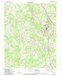
1965 Map of Chatham
USGS Topo · Published 1994About this map
Chatham serves as the focal point of this Pittsylvania County survey, highlighting the town's role as an educational and institutional hub during the mid-20th century. The landscape is characterized by prominent academic campuses, including Hargrave Military Academy and Chatham Hall Sch, alongside the agricultural focus of the Virginia Polytechnic Institute Tobacco Research Station. To the south, the curiously named settlement of Tight Squeeze sits along the Southern railroad line, while the Chatham State Correctional Unit #15 occupies a central position within the rural hinterland.
Find a feature on this map
56 named features on this map. Tap any name to fly to it.
Don’t see what you’re looking for? This feature index may not catch every label — zoom into the map to look around manually.
Map Details
Editions of this 1965 Chatham Map
3 editions found
Other maps of this area

1921 · Chatham
USGS Topo · 1:48,000

1922 · Callands
USGS Topo · 1:48,000

1923 · Danville
USGS Topo · 1:48,000

1923 · Chatham
USGS Topo · 1:62,500

1924 · Draper
USGS Topo · 1:48,000

1924 · Callands
USGS Topo · 1:62,500

1925 · Danville
USGS Topo · 1:62,500

1926 · Draper
USGS Topo · 1:62,500

1944 · Draper
USGS Topo · 1:62,500

1944 · Callands
USGS Topo · 1:62,500