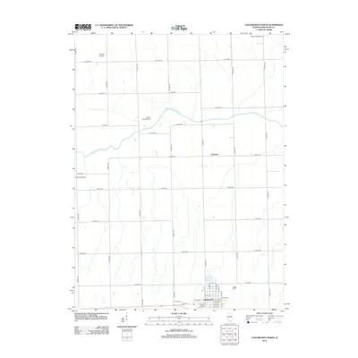
2012 Map of Chatsworth North
USGS Topo · Published 2012About this map
Chatsworth anchors the southern portion of this Livingston County landscape, showing its organized residential grid including streets like E Maple St and E Pine St. North of the town, the terrain is defined by a dense grid of rural routes and the wandering path of the N Fork Vermilion River, which meanders eastward toward the community of Charlotte. This region's agricultural and aviation character is evident in the multiple private airfields scattered across the farmland, such as Sancken Airport, Perkins Landing Strip, and Hahn Landing Strip. The presence of Pleasant Ridge Cem on E 1250 N Rd offers a specific point of interest for genealogists tracing local families in this portion of central Illinois. The map effectively documents the transition from the structured village layout to the expansive sections of the surrounding prairie.
Find a feature on this map
43 named features on this map. Tap any name to fly to it.
Don’t see what you’re looking for? This feature index may not catch every label — zoom into the map to look around manually.
Map Details
Editions of this 2012 Chatsworth North Map
This is the sole edition of this map. No revisions or reprints were ever made.
Other maps of this area

1944 · Piper City
USGS Topo · 1:48,000

1947 · Piper City
USGS Topo · 1:62,500

1947 · Sibley
USGS Topo · 1:62,500

1947 · Cullom
USGS Topo · 1:62,500

1948 · Buckley
USGS Topo · 1:62,500

1949 · Buckley
USGS Topo · 1:62,500

1949 · Cullom
USGS Topo · 1:62,500

1949 · Sibley
USGS Topo · 1:62,500

1958 · Peoria
USGS Topo · 1:250,000

1961 · Peoria
USGS Topo · 1:250,000