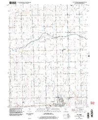
1998 Map of Chatsworth North
USGS Topo · Published 2003About this map
Chatsworth and the surrounding Livingston County farmlands are defined by a grid of rural roads and the winding path of the North Fork Vermilion River. The landscape transitions from the agricultural flats into the elevated terrain of Pleasant Ridge to the west. This late-twentieth-century survey documents the spatial relationship between the primary settlement of Chatsworth and the smaller hamlet of Charlotte, which is supported by local landmarks like the Charlotte Ch and a nearby Gaging Station on the riverbank. Genealogists can locate several key burial sites, including the Pleasant Ridge Cem and the Chatsworth-Charlotte Cem positioned just north of the main township. Smaller locales such as Edwards further illustrate the sparse but organized settlement pattern of the Illinois prairie during this era.
Find a feature on this map
14 named features on this map. Tap any name to fly to it.
Don’t see what you’re looking for? This feature index may not catch every label — zoom into the map to look around manually.
Map Details
Editions of this 1998 Chatsworth North Map
This is the sole edition of this map. No revisions or reprints were ever made.
Other maps of this area

1944 · Piper City
USGS Topo · 1:48,000

1947 · Piper City
USGS Topo · 1:62,500

1947 · Sibley
USGS Topo · 1:62,500

1947 · Cullom
USGS Topo · 1:62,500

1948 · Buckley
USGS Topo · 1:62,500

1949 · Buckley
USGS Topo · 1:62,500

1949 · Cullom
USGS Topo · 1:62,500

1949 · Sibley
USGS Topo · 1:62,500

1958 · Peoria
USGS Topo · 1:250,000

1961 · Peoria
USGS Topo · 1:250,000