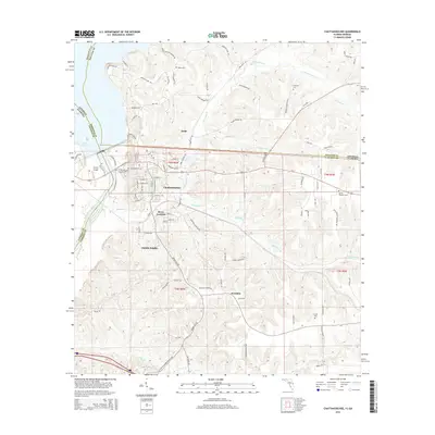
2015 Map of Chattahoochee
USGS Topo · Published 2015About this map
The Apalachicola River defines the western edge of this 2015 study, marking the boundary where Florida and Georgia meet. At this critical river bend, the community of Chattahoochee sits as a central hub, flanked by the residential areas of River Junction and Hardin Heights. The landscape is intricately carved by numerous tributaries, including N Mosquito Cr and Boykin Br, which flow toward the massive expanse of Lake Seminole to the northwest.
Find a feature on this map
106 named features on this map. Tap any name to fly to it.
Don’t see what you’re looking for? This feature index may not catch every label — zoom into the map to look around manually.
Map Details
Editions of this 2015 Chattahoochee Map
This is the sole edition of this map. No revisions or reprints were ever made.
Other maps of this area

1954 · Sneads
USGS Topo · 1:24,000

1954 · Tallahassee
USGS Topo · 1:250,000

1955 · Fairchild
USGS Topo · 1:24,000

1955 · Reynoldsville
USGS Topo · 1:24,000

1955 · Rock Bluff
USGS Topo · 1:24,000

1955 · Sycamore
USGS Topo · 1:24,000

1955 · Chattahoochee
USGS Topo · 1:24,000

1955 · Bainbridge
USGS Topo · 1:62,500

1955 · Mt Pleasant
USGS Topo · 1:24,000

1959 · Tallahassee
USGS Topo · 1:250,000