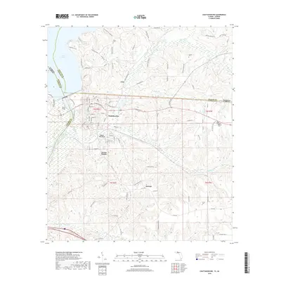
2018 Map of Chattahoochee
USGS Topo · Published 2018About this map
Chattahoochee serves as the focal point of this 2018 survey, situated at the confluence of several Florida and Georgia county lines. The landscape is defined by the massive Lake Seminole and the Apalachicola River, which is spanned by the Victory Bridge near the state border. This modern digital survey reveals a mix of concentrated residential areas and rural expanses, with several established neighborhoods such as River Junction and Hardin Heights appearing alongside outlying areas like Jinks and Rosedale.
Find a feature on this map
99 named features on this map. Tap any name to fly to it.
Don’t see what you’re looking for? This feature index may not catch every label — zoom into the map to look around manually.
Map Details
Editions of this 2018 Chattahoochee Map
This is the sole edition of this map. No revisions or reprints were ever made.
Other maps of this area

1954 · Sneads
USGS Topo · 1:24,000

1954 · Tallahassee
USGS Topo · 1:250,000

1955 · Fairchild
USGS Topo · 1:24,000

1955 · Reynoldsville
USGS Topo · 1:24,000

1955 · Rock Bluff
USGS Topo · 1:24,000

1955 · Sycamore
USGS Topo · 1:24,000

1955 · Chattahoochee
USGS Topo · 1:24,000

1955 · Bainbridge
USGS Topo · 1:62,500

1955 · Mt Pleasant
USGS Topo · 1:24,000

1959 · Tallahassee
USGS Topo · 1:250,000