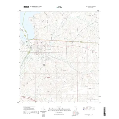
2021 Map of Chattahoochee
USGS Topo · Published 2021About this map
Chattahoochee and River Junction serve as the primary hubs on this Florida-Georgia borderland, situated where the Chattahoochee River and Flint River meet to form the Apalachicola River. This modern digital survey documents the landscape around Lake Seminole, tracking the transition from the waterfront urban centers to the rural communities of Hardin Heights and Rosedale. The map provides significant detail for genealogists, marking several local burial sites including White Cem, Freeman Cem, and Farrell Cem. The complex drainage system of the area is well-defined by numerous waterways like Mosquito Cr, Boykin Br, and Flat Creek, which carve through the terrain of Gadsden and Jackson Counties. Small settlements like Jinks and a network of named roads, such as River Junction Landing Rd and Jinks Crossing Rd, further illustrate the local geography and historical settlement patterns of the panhandle region.
Find a feature on this map
104 named features on this map. Tap any name to fly to it.
Don’t see what you’re looking for? This feature index may not catch every label — zoom into the map to look around manually.
Map Details
Editions of this 2021 Chattahoochee Map
This is the sole edition of this map. No revisions or reprints were ever made.
Other maps of this area

1954 · Sneads
USGS Topo · 1:24,000

1954 · Tallahassee
USGS Topo · 1:250,000

1955 · Fairchild
USGS Topo · 1:24,000

1955 · Reynoldsville
USGS Topo · 1:24,000

1955 · Rock Bluff
USGS Topo · 1:24,000

1955 · Sycamore
USGS Topo · 1:24,000

1955 · Chattahoochee
USGS Topo · 1:24,000

1955 · Bainbridge
USGS Topo · 1:62,500

1955 · Mt Pleasant
USGS Topo · 1:24,000

1959 · Tallahassee
USGS Topo · 1:250,000