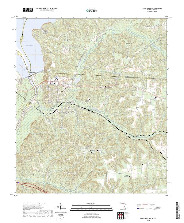
2024 Map of Chattahoochee
USGS Topo · Published 2024About this map
The Apalachicola River forms a major geographic boundary where the Chattahoochee River meets Lake Seminole at the tri-point of Florida and Georgia. This modern topographical study of Gadsden County captures the town of Chattahoochee and the nearby community of River Junction, illustrating how the local geography is defined by the convergence of these major waterways. The map is particularly notable for its dense documentation of local burial sites and family-named landmarks, such as the Florida State Hospital Cemetery and the Elizabeth A M E Church Cemetery. Local history is preserved through the naming of small settlements like Rosedale and Jinks, along with a complex network of creeks including Mosquito Creek and Flat Creek that drain into the larger river systems. The inclusion of the First Methodist Church and numerous rural cemeteries like McAlpin Cemetery and Smyrna Cemetery makes this a valuable record for genealogical research in the Panhandle region.
Find a feature on this map
117 named features on this map. Tap any name to fly to it.
Don’t see what you’re looking for? This feature index may not catch every label — zoom into the map to look around manually.
Map Details
Editions of this 2024 Chattahoochee Map
This is the sole edition of this map. No revisions or reprints were ever made.
Other maps of this area

1954 · Sneads
USGS Topo · 1:24,000

1954 · Tallahassee
USGS Topo · 1:250,000

1955 · Fairchild
USGS Topo · 1:24,000

1955 · Reynoldsville
USGS Topo · 1:24,000

1955 · Rock Bluff
USGS Topo · 1:24,000

1955 · Sycamore
USGS Topo · 1:24,000

1955 · Chattahoochee
USGS Topo · 1:24,000

1955 · Bainbridge
USGS Topo · 1:62,500

1955 · Mt Pleasant
USGS Topo · 1:24,000

1959 · Tallahassee
USGS Topo · 1:250,000