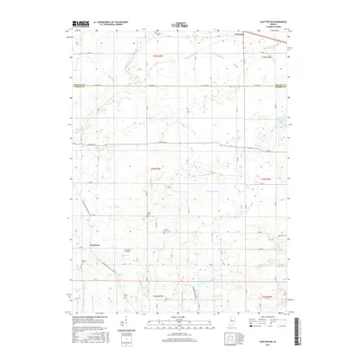
2016 Map of Chatterton
USGS Topo · Published 2016About this map
Foresman and Chatterton anchor this landscape of the Benton and Warren County border, where a complex network of agricultural drainage defines the terrain. The presence of numerous family and community burial grounds, such as Griffin Cem, Mound Cem, and Quaker Cem, suggests a long-standing rural population deeply rooted in this prairie environment. The hydrology is dominated by a systematic grid of man-made channels like Little Blind Ditch and Harrington Ditch, which redirect water into natural arteries including Big Pine Creek and Kickapoo Cr. These improvements transformed the low-lying areas, including Cranberry Marsh, into productive farmland. For those researching local history, the map provides a clear picture of the modern rural infrastructure, including Cottingham Airport, situated among the section lines and gravel roads that have partitioned the Indiana countryside for generations.
Find a feature on this map
41 named features on this map. Tap any name to fly to it.
Don’t see what you’re looking for? This feature index may not catch every label — zoom into the map to look around manually.
Map Details
Editions of this 2016 Chatterton Map
This is the sole edition of this map. No revisions or reprints were ever made.
Other maps of this area

1942 · Otterbein
USGS Topo · 1:24,000

1951 · Otterbein
USGS Topo · 1:24,000

1953 · Danville
USGS Topo · 1:250,000

1955 · Danville
USGS Topo · 1:250,000

1956 · Danville
USGS Topo · 1:250,000

1961 · Chatterton
USGS Topo · 1:24,000

1961 · Pine Village
USGS Topo · 1:24,000

1961 · Otterbein
USGS Topo · 1:24,000
1962 · Round Grove
USGS Topo · 1:24,000

1962 · Templeton
USGS Topo · 1:24,000