
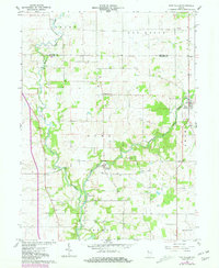
1961 Map of Pine Village
USGS Topo · Published 1962About this map
Big Pine Creek and its tributary Mud Pine Creek carve a winding course through the agricultural landscape of Warren County. In the early 1960s, this area centered on the town of Pine Village, showing a rural community defined by its watercourses and scattered family settlements. The map reveals a high density of small family and community burial grounds, such as Smith Cem, Hooker Cem, and Van Reed Cem, providing essential clues for genealogical research in Pine and Adams townships. Downstream, the settlement of Rainsville sits near a prominent bend in the creek, while locations like Hooker Corner and Brisco represent the persistent crossroads of the rural interior. The presence of a Gravel Pit and the named Rocky Ford highlight the intersection of local geology with early transportation and industry.
Find a feature on this map
24 named features on this map. Tap any name to fly to it.
Don’t see what you’re looking for? This feature index may not catch every label — zoom into the map to look around manually.
Map Details
Editions of this 1961 Pine Village Map
2 editions found
Other maps of this area

1953 · Danville
USGS Topo · 1:250,000

1955 · Danville
USGS Topo · 1:250,000

1956 · Danville
USGS Topo · 1:250,000

1961 · Chatterton
USGS Topo · 1:24,000

1961 · Tab
USGS Topo · 1:24,000

1961 · West Lebanon
USGS Topo · 1:24,000

1962 · Templeton
USGS Topo · 1:24,000

1962 · Boswell
USGS Topo · 1:24,000

1962 · Williamsport
USGS Topo · 1:24,000
1962 · Attica
USGS Topo · 1:24,000