
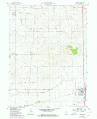
1962 Map of Boswell
USGS Topo · Published 1964About this map
The agrarian landscape of Benton County is meticulously documented here, dominated by the expansive Parish Grove and Hickory Grove townships. In the early 1960s, this area of western Indiana remained a crucial rail junction, where the New York Chicago and St Louis and Chicago and St Louis lines converge at the town of Boswell. These railroads supported a network of smaller shipping points and elevators, such as the storage bins at Dunn.
Find a feature on this map
28 named features on this map. Tap any name to fly to it.
Don’t see what you’re looking for? This feature index may not catch every label — zoom into the map to look around manually.
Map Details
Editions of this 1962 Boswell Map
2 editions found
Other maps of this area

1933 · Hoopeston
USGS Topo · 1:48,000

1938 · Milford
USGS Topo · 1:48,000

1938 · Hoopeston
USGS Topo · 1:62,500

1944 · Milford
USGS Topo · 1:62,500

1953 · Danville
USGS Topo · 1:250,000

1955 · Danville
USGS Topo · 1:250,000

1956 · Danville
USGS Topo · 1:250,000

1961 · Tab
USGS Topo · 1:24,000

1961 · Pine Village
USGS Topo · 1:24,000

1962 · Wadena
USGS Topo · 1:24,000