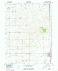
1962 Map of Boswell
USGS Topo · Published 1980About this map
Boswell anchors the southeast corner of this Western Indiana landscape, showing the town's structural layout during a period of transition in rail transport and rural infrastructure. The map details a strictly organized agricultural grid defined by the Parish Grove, Hickory Grove, and Grant townships. Key community hubs include Freeland Park, Dunnington, and Talbot, each serving as focal points for the surrounding farmland.
Find a feature on this map
29 named features on this map. Tap any name to fly to it.
Don’t see what you’re looking for? This feature index may not catch every label — zoom into the map to look around manually.
Map Details
Editions of this 1962 Boswell Map
2 editions found

Other maps of this area

1933 · Hoopeston
USGS Topo · 1:48,000

1938 · Milford
USGS Topo · 1:48,000

1938 · Hoopeston
USGS Topo · 1:62,500

1944 · Milford
USGS Topo · 1:62,500

1953 · Danville
USGS Topo · 1:250,000

1955 · Danville
USGS Topo · 1:250,000

1956 · Danville
USGS Topo · 1:250,000

1961 · Tab
USGS Topo · 1:24,000

1961 · Pine Village
USGS Topo · 1:24,000

1962 · Wadena
USGS Topo · 1:24,000