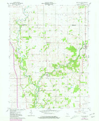
1961 Map of Pine Village
USGS Topo · Published 1981About this map
Big Pine Creek and its tributary Mud Creek dominate this central Warren County landscape, winding through a patchwork of agricultural fields and woodlots. The village of Pine Village serves as the primary hub in the northeast, while smaller clusters like Rainsville and Hooker Corner anchor the rural crossroads. This 1961 field-checked survey preserves the intricate distribution of family-named burial grounds that dot the prairie and creek bluffs, including Smith Cem, Jones Cem, and Van Reed Cem. The mapping of fine red dashed lines indicating fence and field lines, updated from 1976 aerial photography, provides a clear view of land use and property boundaries during the mid-to-late 20th century. Notable local landmarks like the Rocky Ford crossing and the small settlement of Brisco reflect the historical reliance on these waterways for early transport and community organization.
Find a feature on this map
21 named features on this map. Tap any name to fly to it.
Don’t see what you’re looking for? This feature index may not catch every label — zoom into the map to look around manually.
Map Details
Editions of this 1961 Pine Village Map
2 editions found
Other maps of this area

1953 · Danville
USGS Topo · 1:250,000

1955 · Danville
USGS Topo · 1:250,000

1956 · Danville
USGS Topo · 1:250,000

1961 · Chatterton
USGS Topo · 1:24,000

1961 · Tab
USGS Topo · 1:24,000

1961 · Pine Village
USGS Topo · 1:24,000

1961 · West Lebanon
USGS Topo · 1:24,000

1962 · Templeton
USGS Topo · 1:24,000

1962 · Boswell
USGS Topo · 1:24,000

1962 · Williamsport
USGS Topo · 1:24,000