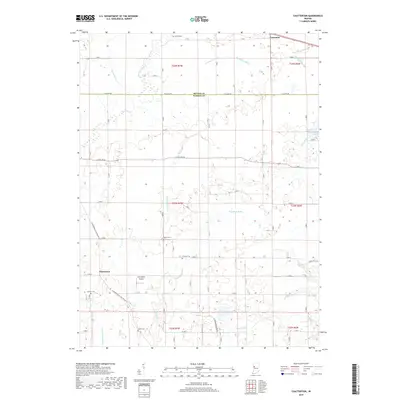
2019 Map of Chatterton
USGS Topo · Published 2019About this map
The boundary between Benton and Warren counties divides a landscape defined by an extensive drainage network, including Harrington Ditch, Moore Ditch, and Bartondale Ditch. These waterways serve a region of structured agriculture and small settlements like Foresman and Chatterton. For family historians, the presence of numerous burial sites, such as Quaker Cem, Griffin Cem, and Mound Cem, offers precise locations for genealogical research in this rural pocket of Indiana. The terrain transitions from the wetland ecology of Cranberry Marsh in the northeast to the various forks of Kickapoo Cr in the south. Aviation history is noted by the presence of Cottingham Airport, situated near the rural intersection of N Independence Pine Village Rd and E 600 N.
Find a feature on this map
43 named features on this map. Tap any name to fly to it.
Don’t see what you’re looking for? This feature index may not catch every label — zoom into the map to look around manually.
Map Details
Editions of this 2019 Chatterton Map
This is the sole edition of this map. No revisions or reprints were ever made.
Other maps of this area

1942 · Otterbein
USGS Topo · 1:24,000

1951 · Otterbein
USGS Topo · 1:24,000

1953 · Danville
USGS Topo · 1:250,000

1955 · Danville
USGS Topo · 1:250,000

1956 · Danville
USGS Topo · 1:250,000

1961 · Chatterton
USGS Topo · 1:24,000

1961 · Pine Village
USGS Topo · 1:24,000

1961 · Otterbein
USGS Topo · 1:24,000
1962 · Round Grove
USGS Topo · 1:24,000

1962 · Templeton
USGS Topo · 1:24,000