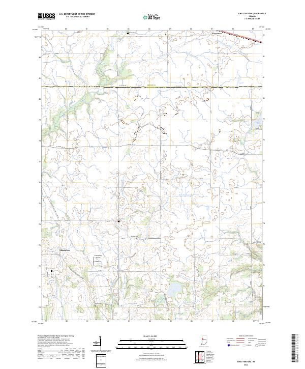
2022 Map of Chatterton
USGS Topo · Published 2022About this map
Agricultural fields and a sophisticated network of drainage ditches define the landscape at the Benton and Warren County line. Central to this rural expanse is the small community of Chatterton, situated near the headwaters of W Fork Kickapoo Cr. The territory is primarily organized around the townships of t23n r7w and t24n r7w, where the presence of numerous small family burial grounds like Griffin Cem, Mound Cem, and Quaker Cem suggests generations of local farming history.
Find a feature on this map
44 named features on this map. Tap any name to fly to it.
Don’t see what you’re looking for? This feature index may not catch every label — zoom into the map to look around manually.
Map Details
Editions of this 2022 Chatterton Map
This is the sole edition of this map. No revisions or reprints were ever made.
Other maps of this area

1942 · Otterbein
USGS Topo · 1:24,000

1951 · Otterbein
USGS Topo · 1:24,000

1953 · Danville
USGS Topo · 1:250,000

1955 · Danville
USGS Topo · 1:250,000

1956 · Danville
USGS Topo · 1:250,000

1961 · Chatterton
USGS Topo · 1:24,000

1961 · Pine Village
USGS Topo · 1:24,000

1961 · Otterbein
USGS Topo · 1:24,000
1962 · Round Grove
USGS Topo · 1:24,000

1962 · Templeton
USGS Topo · 1:24,000