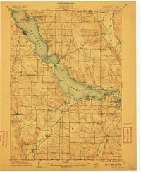
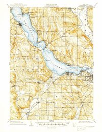
1904 Map of Chautaqua
USGS Topo · Published 1910About this map
Chautauqua Lake anchors this early 20th-century landscape, serving as a primary corridor for transit and leisure. The map meticulously charts the Steamboat Route navigating the lake's center, connecting the cultural hub of Chautauqua with the northern terminus at Mayville and southern resorts like Celoron and Lakewood. The arrival of modern mobility is evident in the Chautauqua Traction Co and the Electric RR lines that trace the shorelines, signaling the era's shift from water-based travel to rapid rail transit.
Find a feature on this map
71 named features on this map. Tap any name to fly to it.
Don’t see what you’re looking for? This feature index may not catch every label — zoom into the map to look around manually.
Map Details
Editions of this 1904 Chautaqua Map
6 editions found
Other maps of this area

1899 · Westfield
USGS Topo · 1:62,500

1900 · Dunkirk
USGS Topo · 1:62,500

1900 · Cherry Creek
USGS Topo · 1:62,500

1904 · Chautaqua
USGS Topo · 1:62,500

1905 · Clymer
USGS Topo · 1:62,500

1905 · Jamestown
USGS Topo · 1:62,500

1906 · Warren
USGS Topo · 1:62,500

1907 · Warren
USGS Topo · 1:62,500

1908 · Warren
USGS Topo · 1:62,500

1926 · Youngsville
USGS Topo · 1:62,500