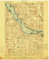
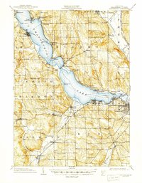
1904 Map of Chautaqua
USGS Topo · Published 1918About this map
Chautauqua Lake dominates this Western New York landscape at the turn of the century, serving as a vital corridor for both transit and tourism. A designated Steamboat Route zigzags across the water, connecting established landings like Mayville at the northern tip with lakeside communities such as Bemus Point and Chautauqua. The southeastern shore is heavily industrialized near Jamestown, where the Chautauqua Traction Co (Electric) line and the Erie RR converge.
Find a feature on this map
68 named features on this map. Tap any name to fly to it.
Don’t see what you’re looking for? This feature index may not catch every label — zoom into the map to look around manually.
Map Details
Editions of this 1904 Chautaqua Map
6 editions found
Other maps of this area

1899 · Westfield
USGS Topo · 1:62,500

1900 · Dunkirk
USGS Topo · 1:62,500

1900 · Cherry Creek
USGS Topo · 1:62,500

1904 · Chautaqua
USGS Topo · 1:62,500

1905 · Clymer
USGS Topo · 1:62,500

1905 · Jamestown
USGS Topo · 1:62,500

1906 · Warren
USGS Topo · 1:62,500

1907 · Warren
USGS Topo · 1:62,500

1908 · Warren
USGS Topo · 1:62,500

1926 · Youngsville
USGS Topo · 1:62,500