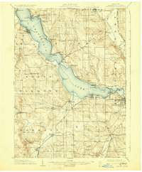
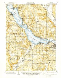
1904 Map of Chautaqua
USGS Topo · Published 1930About this map
Chautauqua Lake anchors this 1902 survey, serving as the central artery for a region defined by its reliance on water and rail transit. The map documents an era of active steam navigation, marking a clear Steamboat Route connecting lakeside communities from Mayville at the northern tip down to Lakewood. This maritime activity was mirrored on land by a dense network of rail lines, including the Chautauqua Lake R. R. and the Jamestown and Chautauqua R. R., which facilitated the movement of passengers and goods through the hills of Chautauqua and Victoria.
Find a feature on this map
66 named features on this map. Tap any name to fly to it.
Don’t see what you’re looking for? This feature index may not catch every label — zoom into the map to look around manually.
Map Details
Editions of this 1904 Chautaqua Map
6 editions found
Other maps of this area

1899 · Westfield
USGS Topo · 1:62,500

1900 · Dunkirk
USGS Topo · 1:62,500

1900 · Cherry Creek
USGS Topo · 1:62,500

1904 · Chautaqua
USGS Topo · 1:62,500

1905 · Clymer
USGS Topo · 1:62,500

1905 · Jamestown
USGS Topo · 1:62,500

1906 · Warren
USGS Topo · 1:62,500

1907 · Warren
USGS Topo · 1:62,500

1908 · Warren
USGS Topo · 1:62,500

1926 · Youngsville
USGS Topo · 1:62,500