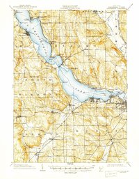
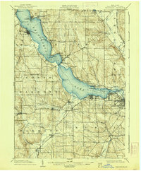
1904 Map of Chautauqua
USGS Topo · Published 1947About this map
Chautauqua Lake dominates this 1902 survey, serving as the central artery for a region defined by its water-based transport and lakeside settlements. The map illustrates a thriving early 20th-century landscape where a dedicated Steamboat Route connects prominent points like Bemus Point and Victoria, while the Chautauqua Lake RR and Jamestown and Chautauqua RR hug the shorelines. To the southeast, the industrial hub of Jamestown sits at the head of the Chadakoin River, while smaller communities such as Celoron and Lakewood show the early residential expansion along the water. Beyond the lake, the map records rural agriculture and family-named landmarks like Starr Farm and Alden Corners. Notable topographic details include several prominent points reaching into the lake, such as Long Pt. and Cheney Pt., and the western village of Panama, set against the hills of Harmony.
Find a feature on this map
66 named features on this map. Tap any name to fly to it.
Don’t see what you’re looking for? This feature index may not catch every label — zoom into the map to look around manually.
Map Details
Editions of this 1904 Chautauqua Map
6 editions found
Other maps of this area

1899 · Westfield
USGS Topo · 1:62,500

1900 · Dunkirk
USGS Topo · 1:62,500

1900 · Cherry Creek
USGS Topo · 1:62,500

1904 · Chautaqua
USGS Topo · 1:62,500

1905 · Clymer
USGS Topo · 1:62,500

1905 · Jamestown
USGS Topo · 1:62,500

1906 · Warren
USGS Topo · 1:62,500

1907 · Warren
USGS Topo · 1:62,500

1908 · Warren
USGS Topo · 1:62,500

1926 · Youngsville
USGS Topo · 1:62,500