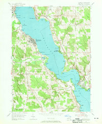
1954 Map of Chautauqua
USGS Topo · Published 1969About this map
Chautauqua Institution stands as a focal point on the western shore of Chautauqua Lake, its dense grid of streets and landmarks like the Amphitheater and Bell Tower reflecting the area's significance as a cultural and educational center. This mid-century survey captures the lake's shoreline before modern intensification, showing a landscape defined by seasonal camps, resorts, and small villages like Dewittville and Bemus Point. The presence of the State Fish Hatchery near Prendergast Point and the Central School at Bemus Point illustrates the civic and state infrastructure of the era.
Find a feature on this map
75 named features on this map. Tap any name to fly to it.
Don’t see what you’re looking for? This feature index may not catch every label — zoom into the map to look around manually.
Map Details
Editions of this 1954 Chautauqua Map
3 editions found
Other maps of this area

1899 · Westfield
USGS Topo · 1:62,500

1900 · Dunkirk
USGS Topo · 1:62,500

1904 · Chautaqua
USGS Topo · 1:62,500

1905 · Clymer
USGS Topo · 1:62,500

1939 · Clymer
USGS Topo · 1:62,500

1941 · Chautauqua
USGS Topo · 1:62,500

1941 · Clymer
USGS Topo · 1:62,500

1943 · Dunkirk
USGS Topo · 1:62,500

1954 · Chautauqua
USGS Topo · 1:24,000

1954 · Ellery Center
USGS Topo · 1:24,000