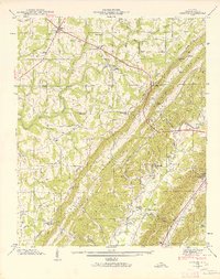
1946 Map of Chavies
USGS Topo · Published 1964About this map
Big Wills Valley and Little Wills Valley slice through the DeKalb County landscape, partitioned by the long ridge of the Divide. This 1946 field examination captures the rural character of the Alabama plateau before modern suburbanization, centered on the intersection of the Tennessee River Road and the early development of Rainsville. The map illustrates a landscape defined by its topography and water access, with established crossings like Suttell Ford and Bohannon Ford serving the community alongside industry landmarks such as Hughes Mill and Killian Mill.
Find a feature on this map
62 named features on this map. Tap any name to fly to it.
Don’t see what you’re looking for? This feature index may not catch every label — zoom into the map to look around manually.
Map Details
Editions of this 1946 Chavies Map
3 editions found
Other maps of this area

1886 · Stevenson
USGS Topo · 1:125,000

1892 · Stevenson
USGS Topo · 1:125,000

1893 · Fort Payne
USGS Topo · 1:125,000

1895 · Stevenson
USGS Topo · 1:125,000

1898 · Fort Payne
USGS Topo · 1:125,000

1900 · Fort Payne
USGS Topo · 1:125,000

1936 · Crossville
USGS Topo · 1:24,000

1936 · Dugout Valley
USGS Topo · 1:24,000

1936 · Chavies
USGS Topo · 1:24,000

1936 · Dutton
USGS Topo · 1:24,000