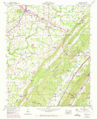
1946 Map of Chavies
USGS Topo · Published 1972About this map
Sand Mountain and Lookout Mountain dominate this Alabama landscape, separated by the deep corridor of Big Wills Valley. The 1946 survey, updated with 1970 aerial data, reveals a network of agrarian communities and gap-focused transit. Rainsville serves as a northern hub, complete with a Drive-In Theater and Athletic Field, while the Southern Railroad railroad tracks parallel the valley floor near Fort Payne.
Find a feature on this map
80 named features on this map. Tap any name to fly to it.
Don’t see what you’re looking for? This feature index may not catch every label — zoom into the map to look around manually.
Map Details
Editions of this 1946 Chavies Map
3 editions found
Other maps of this area

1886 · Stevenson
USGS Topo · 1:125,000

1892 · Stevenson
USGS Topo · 1:125,000

1893 · Fort Payne
USGS Topo · 1:125,000

1895 · Stevenson
USGS Topo · 1:125,000

1898 · Fort Payne
USGS Topo · 1:125,000

1900 · Fort Payne
USGS Topo · 1:125,000

1936 · Crossville
USGS Topo · 1:24,000

1936 · Dugout Valley
USGS Topo · 1:24,000

1936 · Chavies
USGS Topo · 1:24,000

1936 · Dutton
USGS Topo · 1:24,000