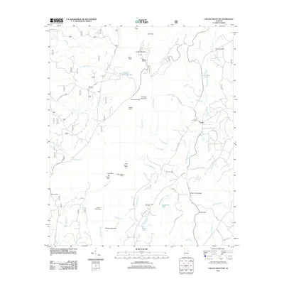
2011 Map of Cheaha Mountain
USGS Topo · Published 2011About this map
Cheaha Mountain and the surrounding high ridges of Talladega Mountain dominate this part of Alabama, where steep terrain dictates the placement of roads and small communities. The settlement of Union sits at a crossroads in the eastern half of the map, supported by several nearby burial grounds including Union Cemetery and Mannings Chapel Cemetery. The landscape is a network of ridges and gaps, notably Adams Gap and Cauley Gap, which channel local travel through the valleys of Ketchepedrakee Creek and Talladega Creek. Small bodies of water like Lake Henry, Cheaha Lake, and Burchfield Lake are scattered among the peaks, providing rare flat points in an otherwise vertical environment. These water features, along with named summits such as Hernandez Peak and McDill Point, illustrate the complex topography that has historically isolated and defined the local townships and family homesteads near Ebenezer Cemetery.
Find a feature on this map
59 named features on this map. Tap any name to fly to it.
Don’t see what you’re looking for? This feature index may not catch every label — zoom into the map to look around manually.
Map Details
Editions of this 2011 Cheaha Mountain Map
This is the sole edition of this map. No revisions or reprints were ever made.
Other maps of this area

1891 · Ashland
USGS Topo · 1:125,000

1900 · Anniston
USGS Topo · 1:125,000

1947 · Oxford
USGS Topo · 1:24,000

1947 · Munford
USGS Topo · 1:24,000

1950 · Anniston
USGS Topo · 1:62,500

1953 · Atlanta
USGS Topo · 1:250,000

1956 · Munford
USGS Topo · 1:24,000

1956 · Oxford
USGS Topo · 1:24,000

1957 · Atlanta
USGS Topo · 1:250,000

1958 · Atlanta
USGS Topo · 1:250,000