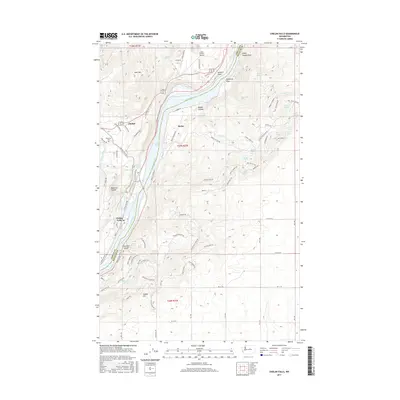
2017 Map of Chelan Falls
USGS Topo · Published 2017About this map
The Columbia River dominates this 2017 landscape, carving a deep boundary between Chelan Co and Douglas Co. The city of Chelan and the settlement of Beebe sit at a geographic transition where the Chelan River flows toward its confluence, while the impounded waters of Lake Entiat stretch along the river corridor. The topography is defined by significant elevation changes, from the heights of Deer Mtn and Chelan Hill down into the eroded corridors of McNeil Canyon, Daybreak Canyon, and Farnham Canyon.
Find a feature on this map
92 named features on this map. Tap any name to fly to it.
Don’t see what you’re looking for? This feature index may not catch every label — zoom into the map to look around manually.
Map Details
Editions of this 2017 Chelan Falls Map
This is the sole edition of this map. No revisions or reprints were ever made.
Other maps of this area

1901 · Chelan
USGS Topo · 1:125,000

1953 · Ritzville
USGS Topo · 1:250,000

1957 · Wenatchee
USGS Topo · 1:250,000

1959 · Ritzville
USGS Topo · 1:250,000

1965 · Ritzville
USGS Topo · 1:250,000

1968 · Withrow
USGS Topo · 1:24,000

1968 · Chelan
USGS Topo · 1:24,000

1968 · Lamoine
USGS Topo · 1:24,000

1968 · Chelan Falls
USGS Topo · 1:24,000

1968 · Wells Dam
USGS Topo · 1:24,000