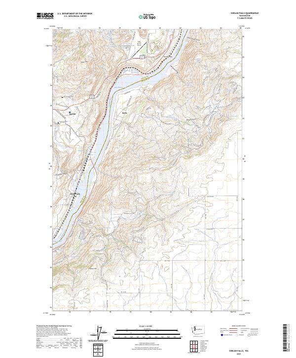
2023 Map of Chelan Falls
USGS Topo · Published 2023About this map
Lake Entiat dominates the center of this landscape, marking the reach of the Columbia River as it divides Chelan and Douglas counties. This 2023 survey illustrates the modern layout of Chelan Falls and the neighboring community of Beebe, where the landscape is defined by the steep transition from the river valley to the surrounding plateaus. The topography is deeply etched by natural drainage features like McNeil Canyon and Daybreak Canyon, which descend toward the water. Local infrastructure is well-established, including the Lake Chelan Airport and the residential expansion of Chelan Hill. For those tracing family histories or land use, the map identifies local landmarks such as Mount Olivet Cem and Riverview Cem, alongside numerous water sources like Beebe Spring and Hendricks Spring that indicate the essential role of hydrology in this arid Washington interior.
Find a feature on this map
98 named features on this map. Tap any name to fly to it.
Don’t see what you’re looking for? This feature index may not catch every label — zoom into the map to look around manually.
Map Details
Editions of this 2023 Chelan Falls Map
This is the sole edition of this map. No revisions or reprints were ever made.
Other maps of this area

1901 · Chelan
USGS Topo · 1:125,000

1953 · Ritzville
USGS Topo · 1:250,000

1957 · Wenatchee
USGS Topo · 1:250,000

1959 · Ritzville
USGS Topo · 1:250,000

1965 · Ritzville
USGS Topo · 1:250,000

1968 · Withrow
USGS Topo · 1:24,000

1968 · Chelan
USGS Topo · 1:24,000

1968 · Lamoine
USGS Topo · 1:24,000

1968 · Chelan Falls
USGS Topo · 1:24,000

1968 · Wells Dam
USGS Topo · 1:24,000