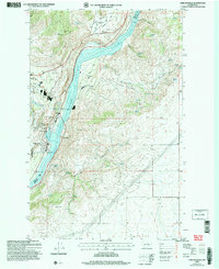
2004 Map of Chelan Falls
USGS Topo · Published 2008About this map
The Columbia River forms a dramatic central corridor through this 2004 revision, where the impounded waters of Lake Entiat meet the rugged slopes of Deer Mountain and Chelan Hill. The map documents a complex infrastructure of water management and transportation, featuring the Beebe Bridge spanning the river and the Chelan State Fish Hatchery located near the riverbank. This area represents a key nexus of local industry and public service, with the Chelan Municipal Airport situated on Howard Flats and the Chelan Butte State Wildlife Area covering the southern hills.
Find a feature on this map
46 named features on this map. Tap any name to fly to it.
Don’t see what you’re looking for? This feature index may not catch every label — zoom into the map to look around manually.
Map Details
Editions of this 2004 Chelan Falls Map
This is the sole edition of this map. No revisions or reprints were ever made.
Other maps of this area

1901 · Chelan
USGS Topo · 1:125,000

1953 · Ritzville
USGS Topo · 1:250,000

1957 · Wenatchee
USGS Topo · 1:250,000

1959 · Ritzville
USGS Topo · 1:250,000

1965 · Ritzville
USGS Topo · 1:250,000

1968 · Withrow
USGS Topo · 1:24,000

1968 · Chelan
USGS Topo · 1:24,000

1968 · Lamoine
USGS Topo · 1:24,000

1968 · Chelan Falls
USGS Topo · 1:24,000

1968 · Wells Dam
USGS Topo · 1:24,000